
Robots/Parts/Senses
Satellite positioning (GNSS)
A satellite positioning receiver, the same idea as the GPS in a phone. It listens to signals from several groups of navigation satellites to work out roughly where the robot is on Earth. It only works outdoors with a view of the sky, and its answer is good to a few metres, so the robot uses its cameras and laser scanner for the fine detail.
- 1 of 15
- robots in the database
- Not named
- made by
- Senses
- brain layer
- Not public
- price
Key numbers
- Model
- not named by AgiBot
- Satellite systems
- GPS, BeiDou, GLONASS and Galileo
- Accuracy
- about 2.5 m outdoors
- Updates
- once a second
- What it reports
- latitude, longitude and height
Source: AgiBot AimDK_X2 docs, 1.6 AgiBot X2 Sensor Overview (x2-aimdk.agibot.com)
Strengths and trade-offs
Our analysisStrengths
Tells the robot where it is outdoors without any map or setup.
Uses four satellite systems, so it usually has enough satellites in view.
Small, cheap and low-power.
Its error does not build up over time, unlike a motion sensor.
Trade-offs
Does not work indoors or under heavy cover.
Only accurate to a few metres, far too rough for walking or handling things.
Updates once a second, slow next to the robot's other sensors.
Unnamed, so its quality cannot be compared between robots.
Why robot makers choose it
Our readA robot that goes outside, for example to guide visitors around a site, needs a rough idea of where it is on a map. Satellite positioning gives that cheaply, and the robot's cameras and laser scanner then handle the last few metres.
This is our reasoning from the public facts. No maker has confirmed it.
Robots using it
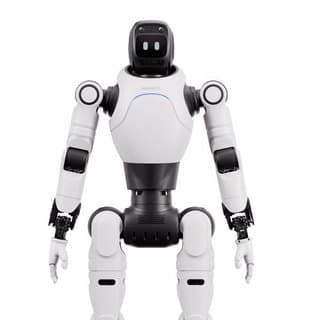
This list covers only the robots researched so far. A robot missing here may still use this part.
Numbers and listed prices on this page come from the sources shown. Anything marked as our analysis, our read or our estimate is our own view and has not been confirmed by any company. Last checked 15 Oct 2026. How we verify